
Trace a Lawton Street Directory Trail
A street address in Lawton can lead through several separate systems. The Comanche County Assessor advertises free owner and address searching plus an interactive property map. That establishes the parcel side of the search. The County Clerk then indexes recorded land instruments by people and legal descriptions. Neither source is a household list. A voter check is individual, not a public street roster, and a reverse directory is historical evidence rather than a current roll. Keeping those roles separate makes the street directory trail much more reliable.
- Normalize the Lawton address first. Keep the house number, compass direction, street name, and street type together, because a direction or abbreviation can change the result.
- Use the assessor's advertised property search, then the map, to locate the parcel. If the online interface does not load, ask the Assessor in Room 301 for help with the address or parcel.
- Record the situs address, owner mailing address, parcel or account number if displayed, and legal description. The situs is the physical property location; a mailing address is where notices go.
- Search the current owner as grantee in the County Clerk index, verify the legal description on the purchase instrument, and follow the seller backward through earlier grantee entries.
- If a name must be checked, the Oklahoma voter portal requires the registered name and date of birth. For older households, ask the Lawton library about reverse or criss-cross directory volumes by address.
That order is deliberate: address, assessor, parcel/map, legal description, deed, then individual voter or old reverse-directory evidence. It avoids treating a mailing label, a parcel outline, or a deed transfer as proof of present occupancy.
Lawton Street Directory Property Search
The Comanche County Assessor is the first official stop for a Lawton street directory search. Its county-linked service advertises a free real-property search and interactive map, with owner-name and property-address searching advertised by the county. The underlying actDataScout pages returned an access block during inspection, so no result-card fields, filter labels, map layers, or historical cutoffs should be assumed. The counter is at 315 SW 5th Street, Room 301, Lawton, and the published telephone numbers are 580-355-1052 and 580-585-6752.
The assessor's home page is shown in the official county assessor view below.
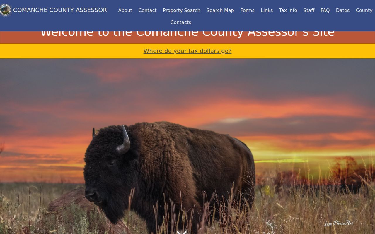
The confirmed functions are a property search and map handoff. When a result is visible, compare the displayed address with the legal description before using it in the deed index.
Comanche County Assessor
Property valuation, tax-roll preparation, exemptions, and the advertised free real-property search and map. Room 301, 315 SW 5th Street; 580-355-1052 or 580-585-6752.
When the portal stops
Use the Room 301 counter or the published assessor contact. The inspected sources did not establish a public parcel-card field list or a historic online cutoff.
Lawton Street Directory Map Clues
A parcel map is useful for geography, not for naming every household. The county advertises map selection and property viewing through its assessor service. Select the street address, note the parcel boundary, and compare nearby parcels only after confirming the street direction. An alley, a street centerline, or a boundary line can make a visual neighbor look less direct in the legal records. The map service itself could not be inspected, so its exact layer list and adjacent-parcel controls remain unverified.
Use a parcel or legal description as the stable bridge. A parcel is the assessor's unit of land recordkeeping. A situs address is the physical land-and-building address. The tax-roll mailing address can point elsewhere, including to a post-office box, business, fiduciary, or another state. Lawton Neighborhood Services says its notices are mailed to the owner address on the Comanche County Treasurer's tax roll. That practice explains a notice address, but it does not establish who occupies the situs.
Note: An advertised map-to-parcel service does not confirm which map layers or result fields are currently public.
Lawton Street Directory Deed Fields
The Comanche County land-record index is where a Lawton street directory trail becomes a recorded-instrument trail. It reports indexed data and images from March 1987 forward, with new records added in real time. Search by the legal description or the people on the instrument, rather than expecting the street address to be the document's legal identity. The free index is distinct from paid research or image access, and a certified instrument belongs with the County Clerk rather than an online download.
The advanced Comanche search includes the verified controls summarized here.
| Verified search route | Confirmed controls | Useful address link |
|---|---|---|
| Name and book/page | Name; Book; Page | Find a recorded party or a known citation. |
| Instrument search | Instrument Number; Instrument type; Recorded Start; Recording End | Narrow a purchase, lien, mortgage, or plat-related filing by date and number. |
| Legal-description search | Legal Description; Quarter Quarter; Quarter; Section; Township; Range | Carry the land description across street-address changes. |
| Subdivision search | Addition; Block; Lot | Match a platted Lawton parcel to its deed trail. |
The county's Land Records page explains that deeds, mortgages, liens, and plats follow different filing paths. A plat links land to a subdivision's lots, blocks, dimensions, easements, and rights of way. It is often the practical link between an ordinary street address and the description used in the clerk index.
The clerk search is pictured in the Comanche County index below.
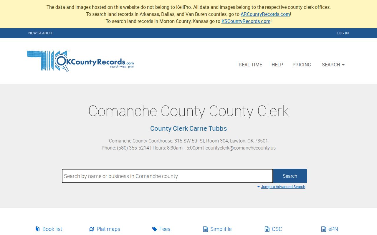
Use the legal-description controls when a name search produces several similar results. The instrument date, number, and grantee-grantor relationship help separate them.
Note: County Clerk image access may differ from public index access, and the counter remains the route for certified copies.
Lawton Street Records by Address
Each address-keyed source answers a narrower question. Together, they make a Lawton street directory more useful than a single name list. They also show why ownership, notices, permits, and recorded documents should not be collapsed into a claim about who is currently at an address.
| Lawton record set | What it can connect | Custodian and access | Important limit |
|---|---|---|---|
| Assessor property search and map | Address, parcel, owner, and map selection when available | Assessor service or Room 301 | Exact online result fields were not inspected. |
| County Clerk land index | Grantor, grantee, instrument, date, and legal description | OKCountyRecords from March 1987; Room 304 for older books | A recorded interest is not occupancy. |
| Treasurer tax roll | Tax account and owner mailing address used for notices | County portal or counter | Mailing address is not situs or a household roster. |
| Permit and planning files | Site, legal description, applicant or owner contact, and project date | Lawton Civic Access, Planning, or License & Permits | Public online result fields and history cutoff were not located. |
| Neighborhood Services files | Address-keyed notice, inspection, or abatement information | Department request or City Clerk request | Not every complaint becomes a confirmed violation. |
| Reverse directories | Historical address-to-occupant clues | Lawton Public Library Family & Local History Room | Exact Lawton criss-cross years are not posted online. |
A request for a permit or neighborhood case should identify the address, record series, and date range. Lawton advertises the Civic Access route for standard permits, but the inspected sources did not verify a public online case search. The city request process and the Oklahoma Open Records Act, 51 O.S. §§ 24A.1–24A.34, are the lawful fallback for a specific record held by a city office.
Note: Carrying the same legal description between Lawton offices is safer than matching a street name alone across separate systems.
Lawton Street Grid and Boundaries
Lawton's official ward map shows numbered streets and named routes such as Cache Road, Gore Boulevard, Lee Boulevard, Railroad Street, Sheridan Road, and several northwest and southwest streets. Copy a compass direction exactly as it appears in the record. Lawton's 1901 townsite, the 1966 annexation expansion, and the June 23, 1998 Fort Sill annexation mean that a city label, postal label, and land-record context can differ over time.
The Lawton City Clerk's corporate-boundaries map is the official local source for current annexation and de-annexation orders, official street names, dedicated streets, alleys, and vacated streets. It is the right place to resolve a municipal boundary question. No official source inspected gave a Lawton-wide street-renumbering date, so an address should not be treated as renumbered merely because an older directory fails to match.
Lawton Street Names in Old Sources
Historic address work needs flexible search language. The Oklahoma Historical Society's home-history guidance notes that newspapers can spell out numbered streets and directions. Search both “twelfth” and “12th,” or “northwest” and “NW,” while retaining the form printed in the source. Old directory entries also use initials, abbreviated given names, and street abbreviations. A matching spouse, occupation, or legal description is more useful than a surname alone.
The Lawton Public Library holds local and neighboring directories and phone books, though it does not publish an exhaustive reverse-directory year run online. When the goal becomes a historic occupant rather than a current street record, the available volumes and their entry structure are addressed in the Lawton city-directory collections. That archive work should be paired with the legal description, not substituted for it.
- Parcel
- A defined unit of land used in assessment and mapping. It helps connect a street address to the records for the land.
- Situs
- The location of the land or building. It differs from the owner mailing address used for tax notices.
- Plat
- A filed map that lays out a subdivision's lots, blocks, streets, easements, and rights of way.
- Criss-cross directory
- An address-first or reverse directory that can place an older occupant clue under a street and number.
Lawton Street Permit File Requests
Permit and neighborhood records can put dates around a building change. Lawton's permit checklists call for a site address, legal description, applicant information, ownership proof or owner permission, and responsible-party contact. That can document an application or alteration, but it does not establish the full household at a location. The public materials inspected did not confirm an online permit-history search, a searchable neighborhood-case database, or either system's historical cutoff.
Lawton Safe and Clean Neighborhood Services handles address-linked concerns such as high vegetation, debris, dangerous structures, sight obstructions, and other maintenance or safety matters. A focused request can be directed to the department, or to the City Clerk when appropriate, rather than asking for a newly created list. The department is at 212 SW 9th Street and publishes 580-581-3467 as its contact number.
Note: An applicant, contractor, owner, or notice recipient may each be a different person tied to the same Lawton address.
Lawton Street Ownership Is Not Occupancy
A deed can show a transfer of recorded interest. An assessor record can identify the tax-side owner and distinguish a mailing address from the situs. Neither establishes that the owner is living there today. The Oklahoma voter portal is also not a public street-browse tool: it uses the registered name and date of birth for individual access, and the State Election Board does not maintain voter telephone numbers. Protected voter and Address Confidentiality Program records may be absent by design.
Utilities, motor-vehicle records, sealed files, and protected addresses are not a street directory. A missing result can reflect a privacy protection, an index gap, a different spelling, or a record held at the counter. Treat it as a reason to verify with the correct custodian, not as evidence about a person.
Note: A protected or absent voter result is not evidence that no person lives at the Lawton address.
Lawton Street Directory Privacy Limits
Lawton street and address research has legitimate personal uses, including family history, estate questions, property curiosity, and checking a record with the office that maintains it. It must remain focused and lawful. The Oklahoma Address Confidentiality Program and the voter Restricted Records program protect qualifying addresses and voter records. Public access under the Oklahoma Open Records Act does not erase those protections or redaction duties.
Lawful use. Use Lawton address records for personal, historical, or civic research only. Do not use a record trail to stalk, harass, threaten, or intimidate any person.
Lawton Street Record Access
Online access is only one channel. For a current parcel question, use the assessor service or Room 301. For a post-March 1987 recorded instrument, begin with OKCountyRecords; for older deeds and indexes, contact the County Clerk Land Records counter in Room 304 at 315 SW 5th Street, 580-355-5214, and ask for the grantor-grantee books or microfilm by legal description. For a city permit or neighborhood record without a verified online search, make a narrow request to the department or City Clerk.
These offices are close together at the courthouse, but they hold different records. Stating the address, legal description, record type, and date range at the outset helps the custodian route the request without turning an address search into an unsupported claim about a household.